
26 Aug 2026 | TECHNOCRAT MAGAZINE | YTC Ventures
Deadly flash floods tore through Nepal’s Himalayan border region on Wednesday after a massive glacier collapse high in the mountains unleashed a powerful ice avalanche. A huge section of glacier broke away, crashed into a river valley below, and sent a destructive surge of water, ice, and debris racing downstream through the Lhende Khola and Bhotekoshi River near the Nepal-China border.
The catastrophic event killed nearly 100 people, left hundreds missing, and devastated villages, roads, bridges, and hydropower projects in Rasuwa and surrounding districts.This Himalayan flash flood ranks among the most dramatic recent examples of an ice avalanche disaster. High-resolution satellite imagery confirmed that a section of glacier roughly 2,000 feet wide snapped off almost cleanly at an altitude of around 17,000 feet.
The enormous block then plunged nearly 4,000 feet to the valley floor, generating the deadly surge that flooded the Lhende Khola and Bhotekoshi River systems.
How the Glacier Collapse Became a Deadly Ice Avalanche
An ice avalanche occurs when a large mass of glacier ice suddenly collapses, often from a steep or overhanging section. In this Nepal glacier collapse, the falling ice carried immense potential energy. Upon impact, much of the ice pulverized into a fast-moving mixture of water, ice fragments, rock, and sediment.
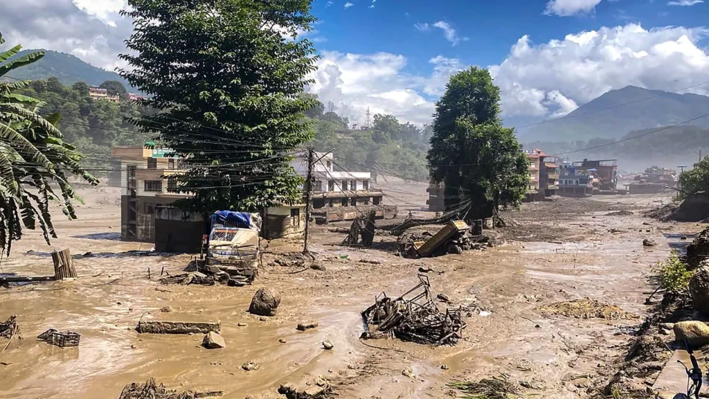
That slurry raced northwest into the Lhende Khola and onward into the Bhotekoshi River, producing the sudden wall of floodwater that swept through Himalayan valleys.Satellite analysis revealed a clean break line on the glacier and a debris field at the bottom that looked as if a bomb had exploded. The scale of the drop—from roughly 17,000 feet down nearly 4,000 feet—turned solid glacier ice into a high-energy flood wave capable of destroying infrastructure and settlements within minutes.
Satellite Imagery and Remote Sensing Technology Uncover the Cause
Modern satellite imagery played a decisive role in identifying the glacier collapse as the trigger of the Nepal flash floods. Commercial Earth-observation satellites captured before-and-after images showing the exact location of the ice avalanche, the clean fracture of the 2,000-foot-wide glacier section, and the resulting debris deposits.
These high-resolution views allowed geologists and glaciologists to confirm the ice avalanche within hours of the disaster.Remote sensing technology also highlighted recent snow and ice melt on nearby glaciers.
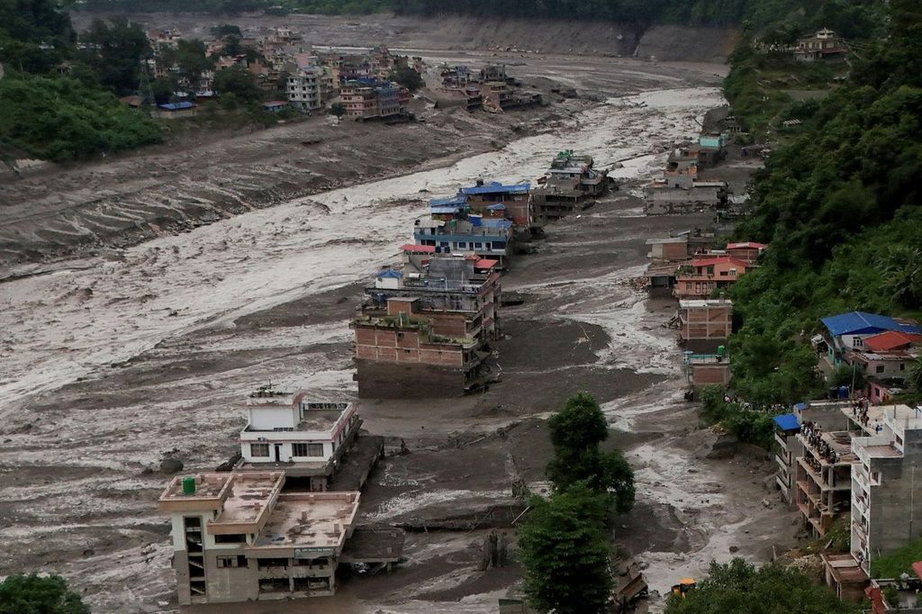
Meltwater can lubricate the base of a glacier, increasing the risk of sudden collapse. This rapid diagnosis demonstrates how satellite monitoring and remote sensing are transforming disaster response in remote Himalayan regions where ground access is limited.
Climate Change, Melting Glaciers, and Rising Himalayan Risks
The Nepal glacier collapse and resulting ice avalanche fit a growing pattern of cryosphere hazards across the Himalayas. Warming temperatures are accelerating glacier melt, reducing ice stability, and raising the frequency of ice avalanches, rockfalls, and glacial lake outburst floods. In this case, evidence of significant recent snow loss suggests that meltwater may have contributed to the glacier’s sudden failure.Himalayan flash floods linked to glacier collapse pose particular danger because steep valleys channel the surge rapidly downstream.
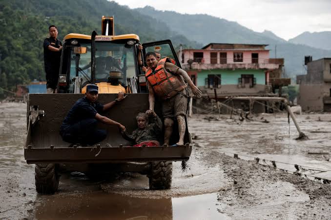
Communities, tourism routes, and hydropower projects along rivers such as the Bhotekoshi face elevated risk as glaciers continue to thin and retreat. The Wednesday disaster is the latest reminder that climate-driven changes in high-altitude ice are creating new cascading hazards for Nepal and the wider Himalayan region.
Lessons for Early Warning Systems and Glacier Monitoring Technology
This ice avalanche and flash flood disaster underscores the urgent need for stronger glacier monitoring systems. Continuous satellite observation, combined with AI-powered change detection, can flag rapid snow loss, glacier movement, and potential instability before collapse occurs. Improved seismic networks that distinguish landslides and ice avalanches from tectonic earthquakes would also reduce confusion in the critical first hours after an event.Cross-border data sharing between Nepal and China, real-time remote sensing alerts, and community early-warning networks can help protect lives along rivers like the Lhende Khola and Bhotekoshi.
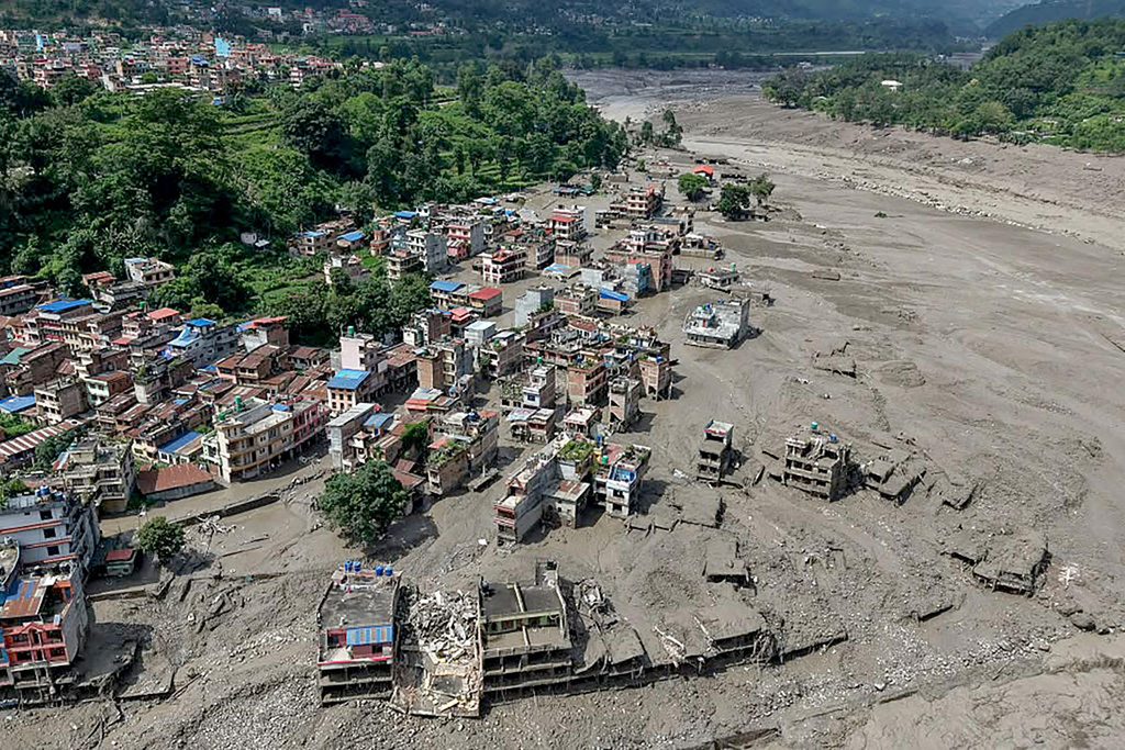
As Himalayan glaciers respond to a warming climate, advanced satellite technology and AI analysis will become essential tools for anticipating ice avalanches and reducing the impact of future flash floods.
The massive glacier collapse that triggered Wednesday’s deadly flash floods in Nepal shows both the power of high-altitude ice and the value of modern remote sensing. By combining satellite imagery, rapid scientific analysis, and improved monitoring systems, authorities can better prepare for the next Himalayan ice avalanche and protect communities living downstream.

Comments