YTC Ventures | Technocrat’ Magazine | www.ytcventures.com
Los Angeles, December 27, 2025
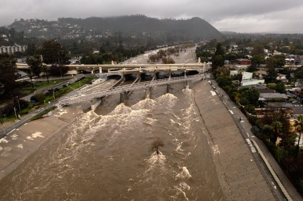
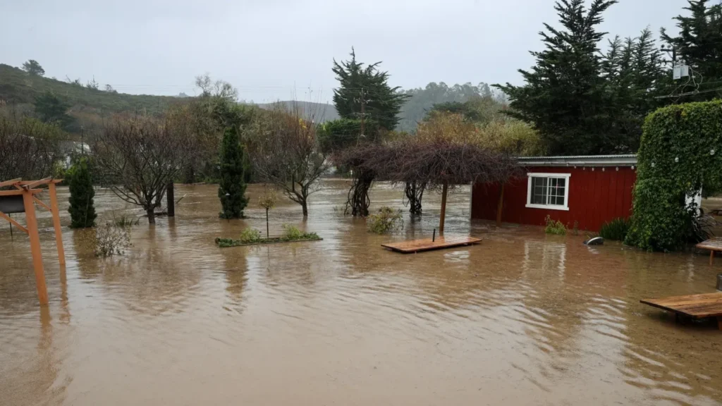
A powerful series of atmospheric rivers battered Southern California this Christmas week, dumping record rainfall that triggered widespread flash flooding, devastating mudslides, and debris flows across the region. The multi-day storm, peaking on Christmas Eve and lingering into Friday, turned streets into rivers, buried homes and vehicles in mud, and forced evacuations in vulnerable communities—particularly those scarred by earlier 2025 wildfires.
The hardest-hit area was the mountain town of Wrightwood in San Bernardino County, where torrents of mud and debris surged through neighborhoods on December 24, encasing cars and homes in feet of thick sludge. Residents spent the holidays digging out, with some properties damaged up to window level. Emergency crews conducted dozens of rescues, including helicopter evacuations from rooftops, but no serious injuries were reported there.
Record Rainfall and Widespread Impacts
The storm delivered extraordinary precipitation, with some mountainous areas receiving up to 12-18 inches of rain over several days. Downtown Los Angeles and nearby airports set daily records on Christmas Eve, marking the wettest Christmas period in decades.Major highways, including stretches of Interstate 5 and Angeles Crest Highway, were closed due to flooding and rockslides.
Gusty winds downed trees and power lines, causing outages for thousands.Governor Gavin Newsom declared a state of emergency in multiple counties, including Los Angeles, Orange, Riverside, San Bernardino, and San Diego, to mobilize resources.
At least three storm-related deaths were reported across California, including vehicle entrapments in floods and a weather-linked crash.
| Location/Area | Rainfall Total (inches, approx. Dec 20-27) | Key Impacts |
|---|---|---|
| Wrightwood (San Bernardino Mtns) | 10-12+ | Severe mudslides, homes buried, evacuations/shelter-in-place |
| San Gabriel Mountains | 8-12 | Debris flows, road closures |
| Los Angeles Basin/Coastal | 4-8 | Urban flooding, freeway closures (e.g., I-5) |
| Ventura/Santa Barbara Counties | 6-10 | Flash floods, high surf, pier closures |
| Foothills/Burn Scar Areas | 8-14 | Heightened mudflow risk in wildfire zones |
Why the Storm Hit So Hard:
Burn Scars and Atmospheric RiversThe intensity was amplified by recent wildfire burn scars from January 2025 fires (e.g., Palisades, Eaton), where vegetation loss left soil unable to absorb water, leading to rapid runoff and “floods on steroids”—as one expert described debris flows.Evacuation orders targeted these zones in Pacific Palisades, Altadena, and Orange County canyons. Officials warned that even light additional rain on saturated ground could trigger more slides through Friday.
Cleanup and Outlook
As rains tapered off on Friday, cleanup efforts ramped up with front-loaders clearing mud-choked roads. Forecasters predict drier conditions this weekend, offering relief before potential new systems next week.
Residents are urged to avoid flooded roads, heed alerts, and prepare sandbags in vulnerable areas. The storm disrupted holiday travel but highlighted California’s vulnerability to extreme weather amid climate shifts.As one Wrightwood resident put it while shoveling mud on Christmas: “We’ve seen heavy rain before, but never this long and intense.” With reservoirs boosted for the water year, the deluge brings both peril and promise—but for now, recovery is the focus.

Comments