Hurricane Gil, the seventh named storm of the 2025 eastern Pacific hurricane season, has captured attention as it churns far from land, peaking as a Category 1 hurricane. With no direct threat to coastal areas, Gil underscores the importance of advanced weather forecasting and technology-driven preparedness.
A hurricane is a powerful tropical cyclone characterized by strong winds, heavy rainfall, and low atmospheric pressure, forming over warm ocean waters. It’s a rotating storm system with sustained winds of at least 74 mph (119 kph), classified as a Category 1 on the Saffir-Simpson Scale, with stronger storms ranging up to Category 5 (157 mph+). Hurricanes develop from tropical disturbances fueled by warm sea surface temperatures (at least 26.5°C), low wind shear, and high humidity. They feature a central eye with calm conditions, surrounded by a violent eyewall of intense winds and rain.
Hurricanes can cause devastating storm surges, flooding, and wind damage, impacting coastal and inland areas. In the eastern Pacific, like Hurricane Gil in 2025, they often form between May and November, with advanced forecasting tech (e.g., NHC’s AI-driven models) tracking their paths to mitigate economic and human losses.
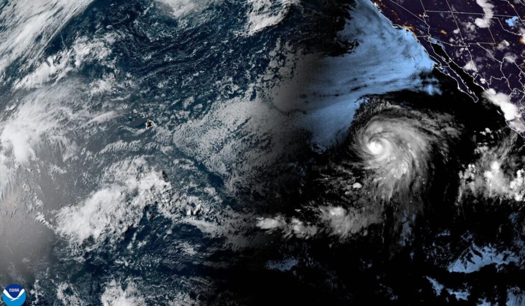
Hurricane Gil’s Path and Status
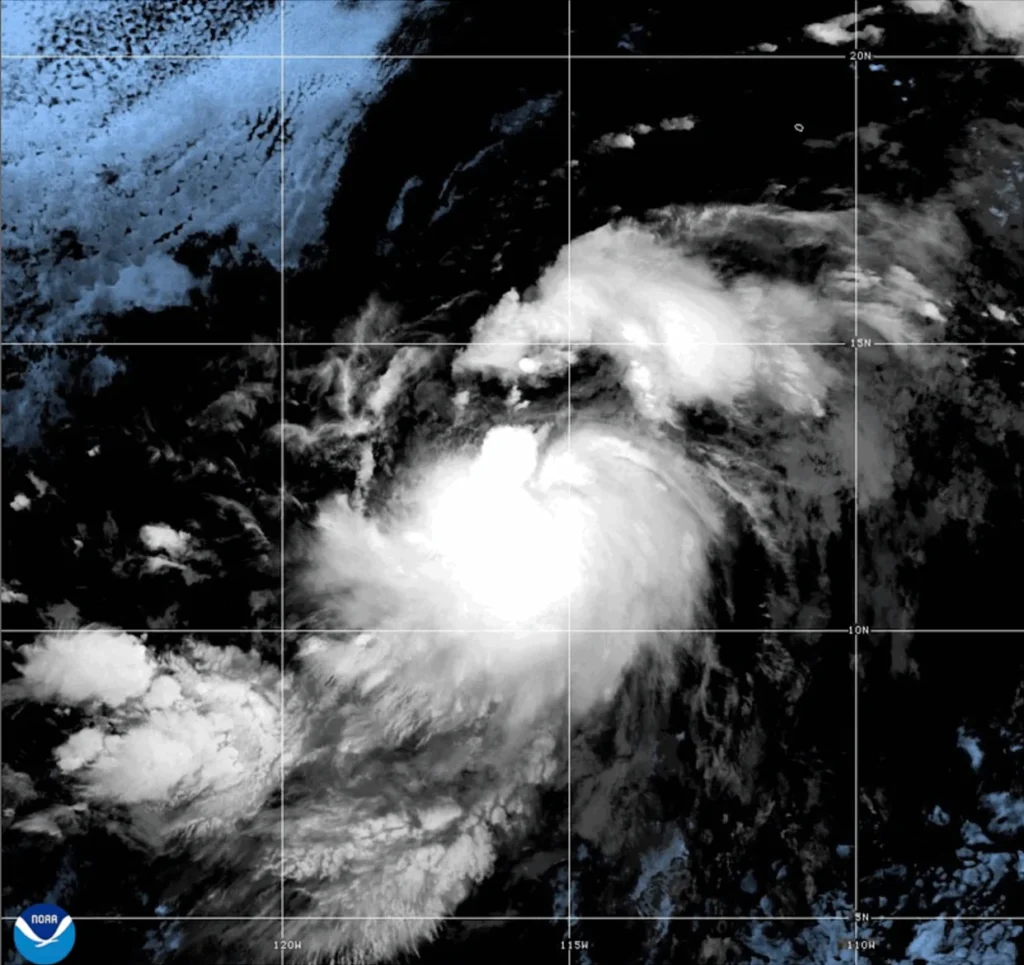
Tropical Storm Gil formed on July 30, 2025, 785 miles south-southwest of Baja California, strengthening into a Category 1 hurricane by August 1 with 75 mph (120 kph) winds, moving west-northwest at 20 mph. By August 2, it was 1,160 miles west-southwest of Baja, with tropical storm-force winds extending 140 miles.
The National Hurricane Center (NHC) predicts Gil will weaken to a tropical storm by August 3 and become post-tropical by August 4 due to cooler waters below 26°C. No coastal warnings are in effect, as Gil’s path keeps it over open water, posing risks only to marine vessels through swells and rip currents.
The storm’s rapid intensification, driven by low wind shear and warm sea temperatures, highlights the 2025 season’s activity, with nine named storms and four hurricanes so far.
Economic and Technological Implications
While Gil avoids landfall, its presence during a busy Pacific season (May 15–November 30) raises concerns for tech-driven industries. Distant storms can generate ocean swells, impacting shipping routes and port operations in the eastern Pacific, critical for tech supply chains. The NHC’s forecasting, powered by satellite imagery and NEXRAD radar, showcases AI and data analytics’ role in predicting storm paths, saving billions in potential damages.
However, the establishment’s narrative of “prepare now” overlooks gaps in rural connectivity, where real-time weather alerts are limited. Businesses reliant on Pacific shipping, like semiconductor firms, face indirect risks from weather disruptions, emphasizing the need for blockchain-based supply chain tracking to enhance resilience.
YTC Ventures Disclaimer: The information provided in this article is for informational purposes only and should not be considered investment or safety advice.

Comments